‘Active Travel’ Maps: Derry/Londonderry, Enniskillen, Limavady, Omagh and Strabane
‘Active Travel’ Maps: Derry/Londonderry, Enniskillen, Limavady, Omagh and Strabane
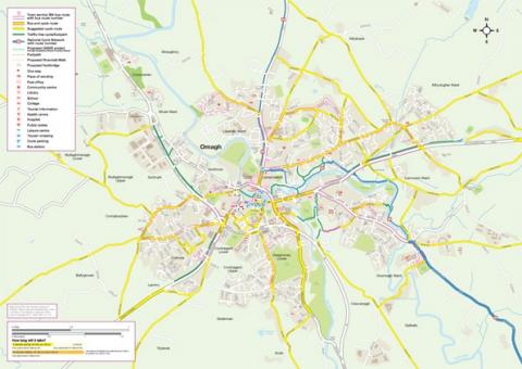
New ‘Active Travel’ Maps, funded by the Public Health Agency, for the cities and towns of Derry/ Londonderry, Enniskillen, Limavady, Omagh and Strabane have been launched to encourage local people and visitors to build physical activity into their day by walking, cycling, jogging, or using public transport.
The Active Maps aim to promote health and wellbeing across the five district councils in the West and contain information on local cycle, walk and bus routes as well as useful contacts such as local cycle hire and sales outlets and walking groups, for example.
Published
18 September 2012
Last reviewed
31 July 2018
Details
Format
Fold-out map
Target group
Residents and visitors to the West
Share this page